There are no items in your basket.
Durham County Record Office Online Shop
Publication
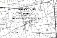
Durham Places in the Mid-Nineteenth Century
Unfortunately this item is currently not in stock. There is a copy available, for reference only, in the County Record Office.
Paperback:
35 pages
Publisher:
Durham County Record Office (1996)
ISBN:
950049220
Dimensions:
29.6 x 21 x 0.8 cm
This index lists place names which appear on the Ordnance Survey, first edition, 6 inches to 1 mile maps of County Durham and part of Yorkshire (North Riding), 1854-1858.
County Durham was surveyed between 1855 and 1858 and is covered by 58 map sheets. That part of Yorkshire which became part of Durham, as a result of local government re-organisation in 1974, was surveyed in 1854 and is covered by 18 map sheets or parts.
Use the index to locate places on the appropriate maps. The information given for each place name includes the map sheet number, map quarter and the township (equating to the later civil parish).